my skills.
The field instruments I have carried, set up and flown, and the software I use to turn what they record into maps, time series and papers.
field instruments
During my PhD at IIT Roorkee, I got the chance to work with many different field surveying instruments. I learned how to handle both traditional surveying tools and newer technologies like UAVs, GPS, and ground sensors through regular and extensive fieldworks.
UAVs
4 tools
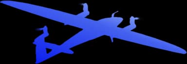
Trinity F90+
Quantum-Systems
I use this fixed-wing VTOL platform when a site needs efficient coverage over a larger area.
Ground Sensors
4 tools
PhenoCam
PhenoCam is central to my PhD work: installing cameras, defining fields of view, and building season-long vegetation time series.
Weather Station
Automatic Weather Station (AWS)
I work with automatic weather stations alongside PhenoCam sites to connect crop development with local weather.
Spectroradiometer
SVC XHR-1024i
I have handled the SVC XHR-1024i in field campaigns to record ground spectral signatures for crop and vegetation studies.
FARO TLS
Terrestrial laser scanner
I use terrestrial laser scanning for dense three-dimensional capture and field demonstrations.
GPS
3 tools
Trimble DA2
Catalyst receiver
A compact GNSS receiver I use for accurate field positioning and geo-tagging observations.

Emlid Reach
RS2 / RS3
I work with Reach receivers for RTK/PPK survey workflows and precise control points.
Sokkia GRX2
GNSS receiver
A survey-grade GNSS system I have handled during field surveys and instrument training.
Surveying
3 tools
Total Station
I have used total stations for conventional field surveying and helped train students during survey camps.
Analytical Theodolite
I learned and taught the fundamentals of precise angular measurement with analytical theodolites.
Digital Level
I use digital levels for elevation transfer and practical surveying exercises.